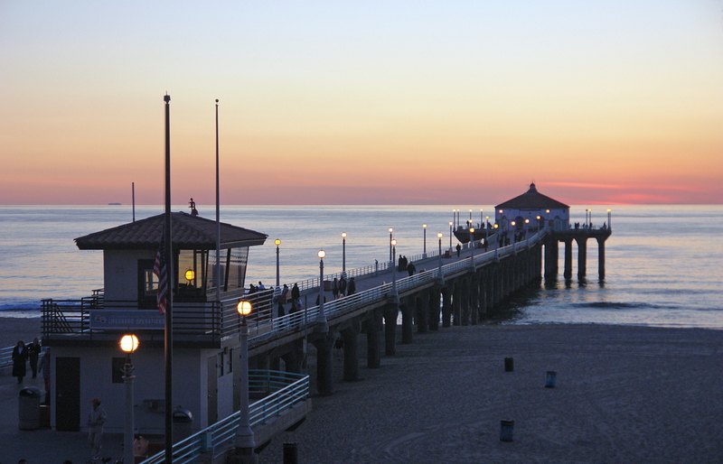
Manhattan Beach Pier

Outdoors

Fishing near Manhattan Beach

Lakes, rivers and recreation areas near Manhattan Beach where fishing is allowed, closest first.

9places to fish
29 mito the closest
1within 30 miles

Good to know: Anyone 16 or older generally needs a state fishing license; seasons, limits and special rules vary by water. California license information ↗

Closest picks

1

Santa Fe Dam

29 mi northeast · US Army Corps of Engineers

Facilities at Santa Fe are operated by Los Angeles County Parks. Swimming, fishing, non-power boating, hiking and picnicking are available. Of interest are the five distinct biological communities within the area.
2

Carbon Canyon Dam

32 mi east · US Army Corps of Engineers

Managed by Orange County, there is no permanent pool, but varied facilities such as fishing, picnic areas, a nature trail, and tennis. The site of the historic oil boom town of Olinda. Adjoins Chino Hills State Park.

3

Crystal Lake

44 mi northeast · USDA Forest Service

Crystal Lake is open, however, campsites are no longer available for reservation on Recreation.gov. Campsites are available on a first-come, first-served basis.

Map of all 9 places

Map of 9 places loads as you scroll.

Within 30 miles (1)

29 mi northeast · US Army Corps of Engineers

Santa Fe Dam

Facilities at Santa Fe are operated by Los Angeles County Parks. Swimming, fishing, non-power boating, hiking and picnicking are available. Of interest are the five distinct biological communities within the area.

  • Boating
  • Fishing
  • Picnicking
  • Water sports
  • Wildlife viewing

30 to 75 miles (6)

32 mi east · US Army Corps of Engineers

Carbon Canyon Dam

Managed by Orange County, there is no permanent pool, but varied facilities such as fishing, picnic areas, a nature trail, and tennis. The site of the historic oil boom town of Olinda. Adjoins Chino Hills State Park.

  • Fishing
  • Hiking
  • Picnicking
  • Wildlife viewing

44 mi northeast · USDA Forest Service · Campground

Crystal Lake

Crystal Lake is open, however, campsites are no longer available for reservation on Recreation.gov. Campsites are available on a first-come, first-served basis.

  • Camping
  • Fishing
  • Hiking

45 mi northeast · USDA Forest Service · Campground

Deer Group Camp

Deer Group Campground is a great place to bring an extended family or large group.

  • Biking
  • Boating
  • Camping
  • Fishing
  • Hiking
  • Swimming
  • Water sports

46 mi southwest · National Park Service · Campground

Santa Barbara Island

Once visitors have scaled the rugged cliffs using the steep trail from the Landing Cove, they will be rewarded with a campground perched on the bluffs with magnificent coastal views.

  • Birding
  • Boating
  • Camping
  • Fishing
  • Guided Interpretive Walks
  • Hiking
  • Information Site
  • Photography

65 mi northwest · Bureau of Reclamation

Lake Casitas

Lake Casitas is formed by Casitas Dam , which is a feature of the Ventura Project . Lake Casitas Recreation Area offers one of the nations best bass fishing areas.

  • Biking
  • Boating
  • Camping
  • Fishing
  • Hiking
  • Nature education
  • Picnicking
  • Ranger programs

67 mi east · USDA Forest Service

San Bernardino National Forest

  • Biking
  • Camping
  • Climbing
  • Fishing
  • Hiking
  • Horse Camping
  • Horseback riding
  • Hunting

75 miles and farther (2)

87 mi west · National Park Service

Channel Islands National Park

Channel Islands National Park encompasses five remarkable islands and their ocean environment, preserving and protecting a wealth of natural and cultural resources.

  • Boating
  • Camping
  • Diving
  • Fishing
  • Hiking
  • Paddling
  • Picnicking
  • Snorkeling

92 mi west · National Oceanic and Atmospheric Administration

Channel Islands National Marine Sanctuary

The waters that swirl around the five islands within Channel Islands National Marine Sanctuary create a special place for several species of plants and animals.

  • Boating
  • Diving
  • Fishing
  • Kayaking
  • Paddling
  • Photography
  • Ranger programs
  • Snorkeling

Distances are straight-line miles from downtown Manhattan Beach. Listings come from Recreation.gov’s federal recreation database; check each official page for hours, fees, fire restrictions and closures before you go.

Get outside around Manhattan Beach

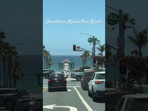
Downtown Manhattan Beach | What’s Your Favorite Beach Town video thumbnail

THINGS TO DO · YOUTUBE SHORT

Downtown Manhattan Beach | What’s Your Favorite Beach Town

A local activity Short shared by Going Places.

Watch on YouTube ↗

Around Manhattan Beach

Manhattan Beach Pier, California
Manhattan Beach Pier, California (40717413642)Pedro Szekely from Los Angeles, USA · CC BY-SA 2.0
Manhattan Beach Golf Course
Manhattan Beach Golf Course (1494449507)Sharon Mollerus · CC BY 2.0
Lifeguard station on Manhattan Beach
Lifeguard station on Manhattan Beachian mcwilliams · CC BY 2.0

More outdoors near Manhattan Beach

Questions

Where is the closest place for fishing near Manhattan Beach?

Santa Fe Dam (US Army Corps of Engineers), about 29 miles northeast of Manhattan Beach as the crow flies. Next are Carbon Canyon Dam (32 mi) and Crystal Lake (44 mi).

Do I need a fishing license near Manhattan Beach?

Yes, anglers 16 and older generally need a California fishing license from the state wildlife agency. Rules, seasons and limits vary by water.

Who manages these places?

Federal agencies including USDA Forest Service, US Army Corps of Engineers, National Park Service. Each listing links to its official page for hours, fees, closures and current conditions.

Manhattan Beach AI

Your Manhattan Beach local guide
Hey there!

I'm Manhattan Beach AI. Ask about neighborhood food, independent shops, local history or planning a visit.

AI recommendations may be inaccurate. Verify hours and prices. Questions are processed by Cloudflare. Privacy